
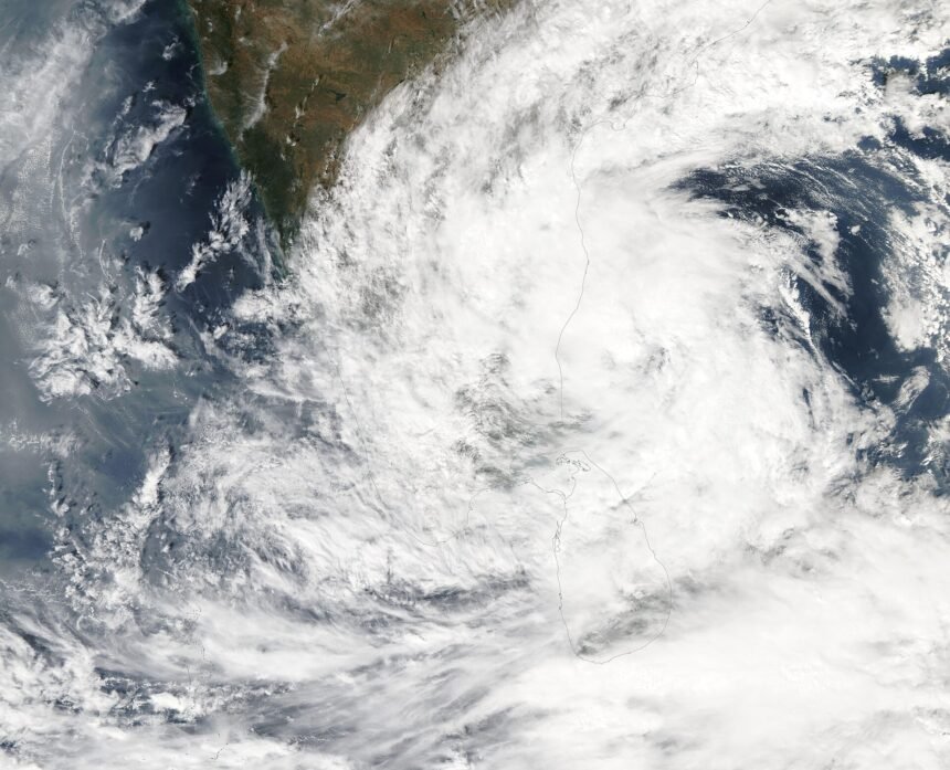
A weather system in the Bay of Bengal is gaining strength, and the India Meteorological Department (IMD) says it could turn into a cyclonic storm by the evening of 16 November. If it does, it will be called Cyclone Akvan. Odisha and north Andhra Pradesh are watching closely, though forecasters say its exact path is still unclear.
The system began as a low-pressure area over the southeast Bay of Bengal at 5:30 am on Friday, 13 November. By the same time on Saturday, it had become a well-marked low, the next step up on IMD’s scale.
What IMD expects over the next three days
According to IMD, the system is very likely to move northwest and become a depression within 24 hours, around the morning of 15 November. After that it is expected to turn north-northwest and strengthen further over the central Bay of Bengal.
The forecast timeline, as it stands on Saturday, looks like this:
- 14 November: well-marked low over the southeast Bay of Bengal
- 15 November: likely depression
- 16 November (evening): possible cyclonic storm over the central Bay of Bengal
An upper-air cyclonic circulation over the central Andaman Sea is feeding the system. Squally winds of 40-50 km/h, gusting to 60 km/h, are forecast over the Andaman Sea and the southeast Bay. Over the southwest and central Bay, winds of 45-55 km/h with gusts up to 65 km/h are expected between 15 and 17 November. Fishermen along the east coast have been advised not to venture into the sea.
Where could Akvan make landfall?
This is the big unknown. IMD has not yet indicated a landfall point, and Madhyamam noted that the storm’s “eventual track and landfall location are yet to be established.”
Several weather models point to the north Andhra Pradesh and south Odisha coasts. Weather expert Prof. Surendranath Pashupalak told Prameya News the system could approach the coast between Visakhapatnam and Gopalpur around 17-18 November. Dr Sarat Chandra Sahu of SOA University said some models show the cyclone forming on 16 November and others on 18 November.
The difference matters for Odisha. Dr Sahu explained that a landfall near Machilipatnam would limit the impact on the state, while one closer to Visakhapatnam could bring heavier rain. Forecasters expect a clearer picture after 15 November.
Rain alert for southern Odisha
The Bhubaneswar Meteorological Centre expects rain in Odisha from 18 November. It will be mostly light to moderate across north coastal, south coastal and southern districts, with heavy rain at isolated places.
On 19 November, heavy rain is possible in Ganjam, Gajapati, Puri and Rayagada, with winds of 30-40 km/h in some areas. The Andaman and Nicobar Islands may see heavy rain until 16 November as the system passes nearby.
Odisha’s Disaster Management Minister Suresh Pujari said precautionary steps have been taken, and district collectors in coastal and southern areas have been alerted. The Special Relief Commissioner’s office will stay open through the weekend to track the system. In Ganjam, leave for government employees was cancelled for 14 and 15 November.
Why farmers are worried
The timing is poor for agriculture. Paddy in much of coastal Odisha is close to maturity, and harvesting is due within days. Strong winds and steady rain can flatten standing crops and cause grain to shed, while waterlogging can damage vegetable fields.
The state is also still recovering from Cyclone Arnab, which hit earlier this season and was followed by floods and landslides. If Akvan forms, it will be the third cyclone of the 2026 post-monsoon season in the north Indian Ocean, after Arnab and Murasu.
How cyclones get their names
Cyclones in the north Indian Ocean are named from a list prepared by the WMO/ESCAP Panel on Tropical Cyclones, a group of 13 countries that includes India, Bangladesh, Sri Lanka, Thailand and Iran. Each member suggests names, and they are used in a fixed order as storms form. “Akvan” is the name contributed by Iran.
A name is only assigned once a system reaches cyclonic storm strength, with sustained winds of at least 62 km/h. Until then, it stays a low or a depression, which is why the name Akvan is still conditional.
What residents should do now
For people in coastal Odisha and north Andhra Pradesh, there is no need for alarm yet, but it is wise to stay updated. Follow IMD bulletins and district administration notices, keep phones charged, and secure loose items outdoors if strong winds are forecast for your area. Farmers who can harvest mature paddy early may want to consider doing so, based on local advice.
IMD issues fresh bulletins several times a day, and the track forecast should firm up once the system becomes a depression.
Reporting based on Sambad English and Prameya News.
Featured image: MODIS Land Rapid Response Team, NASA GSFC, via Wikimedia Commons (Public domain)